
When I crossed the Santee River this morning, on the way out of town, I noticed the water levels were pretty high. On the way back home, I made a couple of stops to see just how high it was.
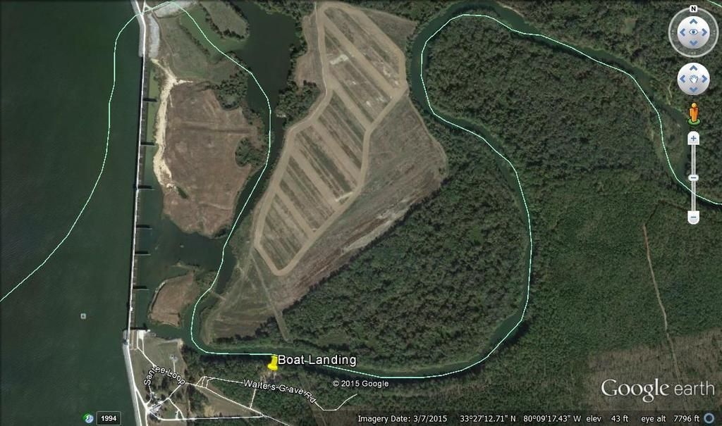
 Somewhere down there is a boat landing, with a parking lot that holds 40 trucks and trailers. The parking is actually under the bridge. It's about 10' below the water at the moment.
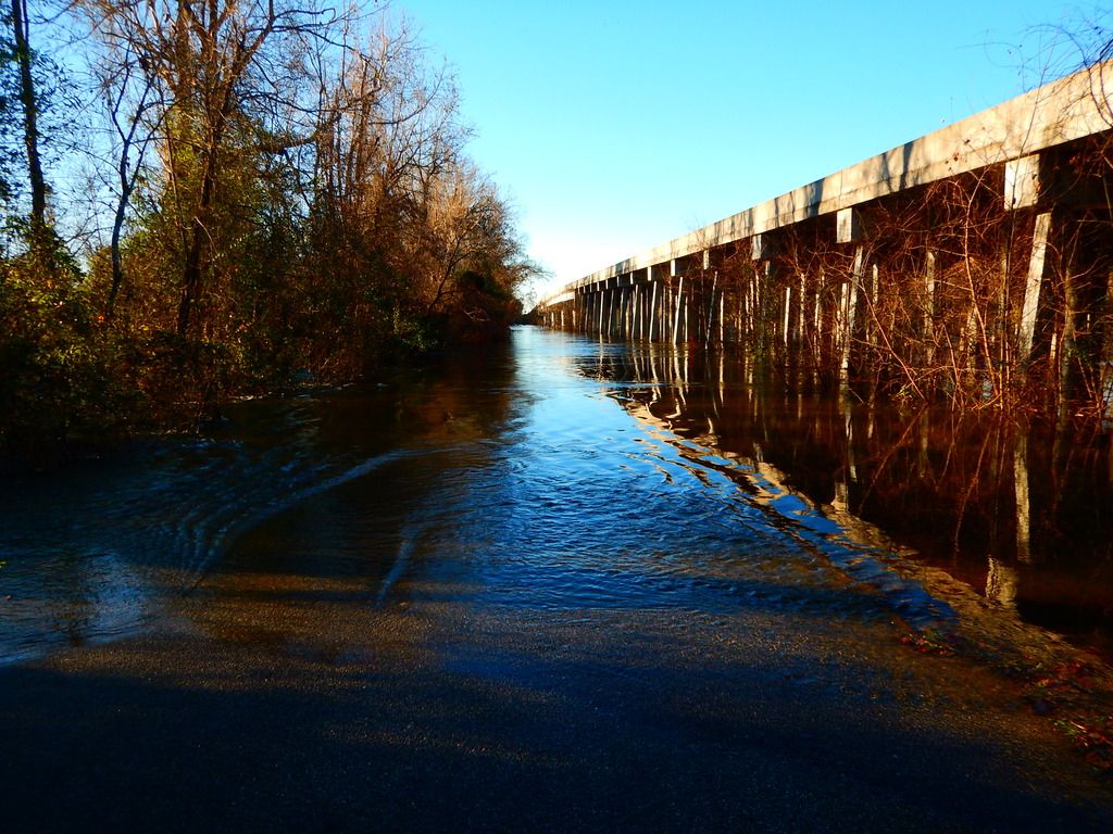
It's moving about 3'/sec. Current levels are 22.1' above flood stage and it isn't supposed to crest until tomorrow at around 23'
https://www.youtube.com/embed/5lsEIjSkk8Y
Normally the river is about 350' wide at this point. Today, the entire flood plain was under flowing water and the flood plain is 4 miles across.
FLow rates at the Jamestown bridge are 90,000 ft3/s. That's 673,000 gal/sec. That's a lot of water. 
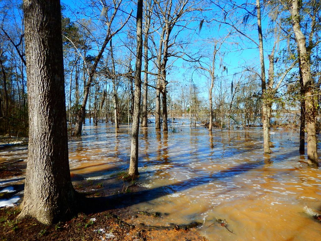
These shots are as close to the base of the dam as I could get. Normal depths is 2-3 feet. I would guess the depth now at closer to 30+ feet.
https://www.youtube.com/embed/hlTnLY9ZiUA
https://www.youtube.com/embed/609NscPYUqA
If you look close in the video, you can see the birds feeding on the fish coming across the spillway.
This is what the area usually looks like. Today it's flooded as far as I could see. I was standing at the boat landing and the roar of the water coming off the spillway was surprisingly loud.
Wow
I noticed this weekend while passing Cairo, IL that the Mississippi was so flooded that we were ~5 miles past the bridge before we saw dry land again.

Brian
MegaDork
1/5/16 8:51 p.m.
Yeah, floods are a bitch. Good luck to those under water.
Big Muddy. The Mother River.

Duke
MegaDork
1/6/16 7:57 a.m.
I remember the spring after I moved to Saint Louis that the Mississip flooded badly enough to engulf the whole riverfront area, and start climbing the steps to the Arch. It was up over the tops of the stone piers of the Eades Bridge and well into the iron trusswork - they were actually pretty afraid that the drag might bend the bridge laterally.

Eads Bridge in the background, Arch steps in the foreground. The water was about halfway up to the guy in black, a little below the first landing.
Too bad we have no way of getting that water to California reservoirs.....

mtn
MegaDork
1/6/16 9:07 a.m.
Duke wrote:
I remember the spring after I moved to Saint Louis that the Mississip flooded badly enough to engulf the whole riverfront area, and start climbing the steps to the Arch. It was up over the tops of the stone piers of the Eades Bridge and well into the iron trusswork - they were actually pretty afraid that the drag might bend the bridge laterally.
Eads Bridge in the background, Arch steps in the foreground. The water was about halfway up to the guy in black, a little below the first landing.
I believe that those steps were built where and how they were to act as a levee.
KyAllroad wrote:
Too bad we have no way of getting that water to California reservoirs.....
Quick, who has a operating fleet of Sikorsky sky cranes and some very large buckets! I smell a business opportunity 
Nick (LUCAS) Comstock wrote:
KyAllroad wrote:
Too bad we have no way of getting that water to California reservoirs.....
Quick, who has a operating fleet of Sikorsky sky cranes and some very large buckets! I smell a business opportunity
Shhh... I bet Steve aka aussiesmg is already combing eBay for a fleet of them to expand his medical transport business!
Nick (LUCAS) Comstock wrote:
KyAllroad wrote:
Too bad we have no way of getting that water to California reservoirs.....
Quick, who has a operating fleet of Sikorsky sky cranes and some very large buckets! I smell a business opportunity
Quick! Call Erickson Sky Cranes!


